Tag Archives: nature

A Hidden Paradise – Exploring the Zingaro Nature Reserve

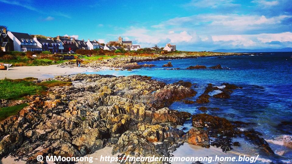
No tarmacked roads in sight, no cars, no concrete houses, no telephone cables, no traffic noise-pollution. Just pure unmitigated peace, small pristine beaches amidst rugged countryside, spectacular sea-views, lush hiking trails, florid plants growing in the shade of rich trees while seagulls circle over picturesque grottos and hedgehogs peep at you from beneath a canopy of leaves. Heaven? Not at all, I found all this and more at the Zingaro Nature Reserve in Sicily.

Tired of the humdrum of everyday life, some months ago I decided to take myself off to Sicily for a long weekend. It wasn’t the first time I had visited the island, and this time I wasn’t interested in exploring cities, going shopping or even admiring historical architecture and art. I just wanted to take a deep breath, stay still and relax for a while. Which is why Zingaro Nature Reserve, located just an hour west of Palermo, near the small town of Scopello, was the perfect place to go. This little paradise opens daily from 7am to 7pm and sports two different entrances, the most popular one being accessible from the coast road that ends just beyond Scopello, while the other less busy entrance is close to San Vito La Capo in the north. We were staying in the village of Trappeto, so the Scopello entrance was the closest one for us. Also, this entrance has a free car park and an information centre, where the very helpful staff gave us a map of the Reserve and its possible trails.

The leaflet informed us that Zingaro Nature Reserve was actually Sicily’s oldest and first protected area, and that it was established as a reserve in 1981. This spectacular location stretches for 7km along the unspoilt coastline of the Bay of Castellammare and its mountain range, and offers hikers and explorers three main trails. The ‘easier’ one is the Coastal trail, which winds around the coast and bays and takes approximately 4-6 hours to traverse from one side of the Reserve to the other. The second one, which is described as ‘Moderate’, is the Middle Coast Trail, which is an 8.5 km winding walk in the middle of the landscape and rural scenery, with the coast on one side and the mountains on the other. The third option is the Tall and Middle Coast Trail, which is the longest route and goes straight through the Bosco of Sardinia, famous for its pine trees. Of course, stating a specific time for how long one will actually take to walk through each trail is very subjective, since this depends on the hardiness of the hikers, the weather conditions, and the terrain. It will definitely take longer if you opt to stop for a picnic. I recommend starting early if you plan on spending the whole day exploring the place, since you definitely don’t want to find yourself crashing through the undergrowth in darkness. There are no electrical external sources of light within the Reserve.

One enters Zingaro proper through a short tunnel. As soon as one emerges from it, the whole enchanting vista of mountains, woodland and coast opens up in a sudden magical light-burst. The main trail splits into a few others but they are very well marked. We chose the Coastal trail, which is a bit hilly and sports some ups and downs, but which is a very good choice particularly in summer. This is because of the 7 different natural beaches found alongside it, not to mention the picturesque craggy coastline. Perfect if you are an avid photographer, or if you just want a dip in the cool water. After a few minutes walking along this trail, we came across the tiny Museum of Marine Activities. I must confess, at this point the thing I found most interesting here was the bathroom, and boy was I fortunate in stopping there! A serious word of advice, toilets at the Reserve are very few and far between since they are only found at the four small museums interspersing the various trails. So, make the most of them!

Cala Mazzo di Sciacca

After around 20 to 30 minutes of walking in the scorching sun of June, we finally spied the first natural cove or cala. This was the Cala Mazzo di Sciacca, a small virgin-white sandy beach with not a soul in sight. The water sparkled as I gazed at it longingly, because yes, obviously, I had forgotten my swimsuit in the car. The temptation to just wade into the azure water au naturel was overwhelming, but thankfully I didn’t give in to it. No sooner had we taken our photos and decided to reluctantly continue to follow the path, than two whole families of tourists descended on us replete with towels, plastic toys and lunchboxes. Many people in fact visit Zingaro Nature Reserve for its unique beaches, so less crowded and so much cleaner than more mainstream swimming locations. Entrance to the Reserve only costs €5 for adults, which is very worth it considering the amazing experience.

Cala Capreria

We continued on towards the next bay on the map, the Cala Capreria. At this point the heat was quite intense, and I was very sorry that we hadn’t thought to bring some water with us. Another note of warning, don’t be as careless as I was. Take drink and food with you because there are no stops and nowhere to buy anything. It is pure unmitigated beautiful wilderness. I did at least think of wearing sturdy tennis shoes and not flip flops or sandals, which would have been terribly uncomfortable on the craggy terrain.

The Reserve sports seven beaches in all; one of which is only accessible by boat. In fact, for those who are not interested in hiking but just want to glory in the popular calas, there are a number of cruises available whereby one can buy a ticket and visit all these beaches and more by boat. Ferries are available from San Vito La Capo and other coastal resorts. Although one need not be a jock or professional athlete to brave walking around the Reserve, it is definitely not for the physically unfit or for those with special physical needs, therefore taking a cruise might be another way of experiencing another side to the location. The waters around the reserve are also excellent for scuba diving. The Zingaro Reserve is wholly pedestrian, meaning that one can only explore it on foot and that no cars may enter this safe space.

Moving on, we arrived at the Punta Leone, which is a natural rock formation supposedly in the shape of a lion. To be honest, I didn’t realise this until it was pointed out to me by a very friendly and helpful ranger. He also shared some of his water with us, for which at this point, I was profoundly grateful – thank you again Vincenzo!!

Image Source: www.eventitrapani.it

Vincenzo also told us that had we started walking from the northern entrance, the once closest to San Vito la Capo, instead of the southern one, the trail we would have traversed would have been less hilly and problematic. Also the four beaches closest to that entrance are closer to each other too, making the trail easier to navigate. He was very boastful of ‘his’ Reserve, talking non-stop about the 650 different species of plants, shrubs, palms and colourful flowers which dot the landscape, as well as mentioning  the local bird population which usually acts as a magnet to those interested in ornithology. These visit the Reserve to study the eagles, falcons, peregrines, partridges, kestrels, owls and seabirds found here. The grottoes and cavers along the coastline are also inhabited by eight different species of bats. Needless to be said, it is forbidden to take rifles or any kind of fishing equipment in the Reserve.

I must admit that at this point I was totally wound up as it was very hot and there was also the return journey to consider (since we had left our car at the parking lot near the southern entrance), therefore I admit that I only walked until mid-way of the coastal trail, that is, as far as the Cala della Disa. Funnily enough, even though the rangers and museum curators encountered along the track continued to tell us that such and such a location was ‘only ten minutes away’, each time the walk was markedly lengthier than that, so try not to take experienced trekkers at face value, especially if, like me, you generally prefer a cool drink and a good book on the couch to a laboriously sweat-drenching walk in the Sicilian sun. However Zingaro Nature Reserve was well-worth the effort. Seriously though, I won’t try to tackle such a track in summer again, as I’m sure the experience would be much more enjoyable in spring or autumn. Still, I will surely visit Zingaro again next time I visit Sicily, even though this time perhaps, I will traverse it from the easier and less hilly Northern side.

This article, written by yours truly, was originally published on The Sunday Times of Malta.

Advertisement

Snowdon – The Highest Mountain in Wales

Whenever we look up at a mountain, one of the first questions we usually ask ourselves is, ‘I wonder what it all looks like from up there?’ Yr Wyddfa, or Snowdon, is no exception. Its summit offers without a doubt, the grandest view in Wales – not a surprise, since at 1.085 meters (3.560 ft) high, Snowdon is the highest mountain in all of not only Wales, but also England. And this is why I absolutely had to visit this monumental site while I was in Wales a while ago.

I must admit – I am not a very sports-minded person. I don’t like walking much, and I have never tried mountain-climbing, which is why I have frequently thought that reaching the summit of a mountain for me would be practically impossible. Fortunately however, I was totally wrong. At least with regards to Snowdon. This is because the summit of Snowdon, also known as the ‘roof of Wales’, can be reached not only on foot, but also by railway. Be warned however, tickets are on a first-come, first-served basis, so the easiest thing to do if you want to journey up the mountain by train, is to visit the official website and book your seats beforehand, instead of trying your luck at the ticket booth. I have spoken to a number of people who made the journey to Snowdon, which is found within the Snowdonia National Park in the county of Gwynedd, and who told me that once they arrived at the ticket booth, they had to leave empty handed, as the train-carriages were all fully booked for that day already. So, it’s much better to plan ahead and make hay while the sun shines.

In front of the small train station

My journey to Snowdon was a memorable one. I had done my homework so I knew that the railway is usually closed from October to March, since the mountain can be quite dangerous during the bad winter-time weather, which is why I visited the park in September. I had also found a number of YouTube videos of the train journey, uploaded by errant tourists, therefore I also realized that the train-carriages were not large, and that they each had limited capacity, which is why I booked my tickets online. When we arrived, we parked our rented car at the Pen-y-Pass car-park, which is directly in front of the restaurant, gift-shop and ticket booth found at the foot of the mountain. There was a very nice parker there who refused to let us pay before we had checked whether the train was actually working on that day or not, since there was a bit of a high wind and trains usually do not make the journey during bad weather (in such cases, full refunds are given). Everything was fine however, so our hope of reaching the summit on that day were fulfilled.

Our train!

The train was really cute and small and we couldn’t refrain from taking some selfies with it. We boarded and started our ride, which we knew would be 4.7 miles (7.6 km) long and take approximately two and a half hours – one hour to the summit, half an hour there, and then another hour back. I was immediately struck by the beautiful atmosphere and panorama which one can admire from the train-carriages itself. These have huge glass panels from where one can take as many photographs as one likes. The train chugged along slowly, both to give us tourists a chance to take pictures, and also because the mountain terrain is not easy to traverse. A multitude of sheep and goats looked at us pass by slowly, while we gazed in wonder at the magical panorama unfolding around us. Gone were all traces of modern civilization, as we were surrounded by nature, animals and plants. Snowdonia National Park is in fact a national nature reserve and contains a large number of rare flora and fauna.

The view from the train

As the driver told us about how Snowdon Mountain was formed out of volcanic rocks sculpted by ice during the Ice Age, we were further amazed to see a waterfall plunging majestically into a 20 metre gorge directly below us. Cameras clicked madly as the train emerged into the open, treeless countryside and we had the first glimpse of the sharp peak of Snowdon. The landscape all around us was dotted with many tiny abandoned, simple shepherd-dwellings. Just behind the ridge, we could also see the Snowdon Ranger path, as well as the youth hostel. Some intrepid young people, burdened with climbing gear, picnic baskets, and jackets, were starting to walk along the track up the mountain and we waved at them gleefully as we passed. While the journey from Llanberis (that is, the foot of the mountain) to the small station at the summit, takes an hour by train, it usually takes around 6 hours covering between 7 to 10 miles, for those who brave the journey on foot, depending of course, on the path taken. There are in fact, six main routes to the summit, ranging from ‘beginner’ to ‘expert’ mountain climbing skills. Climbing the mountain on foot is not as hard as one might think, especially in good weather conditions, however one must keep in mind that the right equipment, know-how, and resources are needed. Mountain slopes can be treacherous and slippery, and in fact a large number of people were injured and even fell and died while climbing this mountain throughout the years.

Snowdon village could be seen below us at this point. We could also see the passage of time when we looked at the old quarry near it, which showed the sedentary rock blending into slate. Very colorful and interesting. As the train continued its journey upwards, we could also see the Hill of the Falcon in the distance – so called because it is the home of a large number of rare Peregrine Falcons, as well as Llydaw Lake, which is one of Snowdonia’s deepest lakes. Half-way up the mountain we stopped in order for the train to re-fill its tanks and for the tourists to have a cup of coffee at the halfway Café. It was really getting chilly at this point, and I bemoaned my fingerless gloves and thin hood, which weren’t nearly enough to protect me from the glacial climate. Beyond the coffee shop, we could see Glaslyn Lake, with its seemingly black and silent waters. I could very well understand how this strange place could inspire people to believe in the legend of the afanc, which is a water-monster who is thought to reside in it. Another legend relating to Snowdon Mountain relates how the giant Rhitta Gawr, who wore a cloak made out of men’s beards, was killed by King Arthur after trying to take his beard, and is buried at the top of Snowdon.

Glaslyn Lake

As we approached the summit, it was so cold that the drops of mist were like rain against the window panes. Everything was obscured as we entered a cloud of condensation, and as the doors opened to admit us to the coffee shop station at the top, we were told to be careful and not miss the train which would go back in 30 minutes, as there would be no more journeys for that day. Frozen stiff and knowing that the best was yet to come, we started walking towards the peak which, we were told, was only a few steep steps ahead. Wet, slippery, uneven steps, which one had to climb in the blinding mist and freezing wind. I admit at this point I was quite scared, but I consoled myself by thinking about the amazing view awaiting me. Snowdon is well known to offer one of the most extensive views of the British Isles – since in good weather Ireland, Scotland, England and the Isle of Man are all visible, as well as 24 counties, 29 lakes, and 17 islands.

Reaching the Summit
The height marker at the peak of the mountain

Unfortunately for me, this was not one of those days. Snowdon is close to the sea which means that the weather changes frequently. The only thing I saw from the summit was a wall of mist. I took a photograph with the height marker at the peak, and we went back for the return one-hour ride. Although I did not get to see the famous panorama I was aiming for, I still feel like it was a memorable experience because the journey up the mountain was an adventure in itself. Still – Snowdon remains an unreachable mystery, so perhaps someday I will go back, and who knows, maybe that day I will try to brave one of its rock-climbing routes on foot.

This article was originally published on The Sunday Times of Malta

The Heavenly Meteora Monasteries

Beautiful sunny Greece is mostly known for its picturesque islands and classical Hellene ruins, however there is at least one other wonder which no traveler should miss. I am referring to the group of six monasteries known as ‘Meteora’, which literally means ‘suspended in the air’, and which are situated at the edge of the plain of Thessaly, in central Greece.

One of the Meteora Monasteries

Defined by UNESCO as a unique phenomenon of cultural heritage, these Eastern Orthodox havens of ancient cultural and religious artifacts and icons, perch majestically on enormous columns of rock rising precipitously from the ground. This rare geological peculiarity is truly one of a kind. As we navigated the winding roads on our rented car, I couldn’t help but wonder at the original monks who, fleeing from the encroaching Ottoman raiders at the end of the 14th century, found refuge in the isolated caves, and then later further up the rocky slopes of Meteora. Originally there were 24 monasteries atop these impossibly imposing natural formations, however unfortunately only six remain active today, as the others all fell into ruin, most notably after the depredations of the second world war, when many were bombed and their art treasures stolen. The six remaining monasteries – testaments to the piety and art of the Orthodox culture, are all situated near each other, so though I recommend renting a car or purchasing a coach ticket to arrive to Meteora itself, one can still continue walking on foot from one monastery to the other. Of course, if you plan on visiting, I would also suggest dedicating at least one full day to visit all six monasteries. There is so much to see!

We rounded a corner and suddenly there it was – a sight I will never forget. I could hardly assimilate how far up we were, not to mention take in the amazing panorama of abrupt vertical rock pinnacles topped with exquisite red-roofed buildings, without wondering how on earth anyone could have built them up there. Especially knowing that the oldest and largest monastery, that of Great Meteoron, had been erected in the 14th century, when construction materials and aides were very limited. We stopped the car to take some photos and realized that we were not the only ones there. Yes, Meteora is underrated, yet there are still many people visiting all year round – not just pilgrims and history buffs, but also rock climbers, trekkers, and simple tourists. Beware though – Meteora is not a site for those who don’t like walking, in fact one must brave a myriad of stone steps cut in the rocks themselves, sheer bridges and wooden platforms, to access the fairytale buildings. Definitely not for the faint-hearted.

My silly boyfriend trying to give me a heart-attack by prancing on the edge

Unfortunately we did not have time to visit all six monasteries, seeing only four of them. The first we went to, the Monastery of Great Meteoron, is surely my favorite one of the lot. It is situated on top of the highest of the inhabited rock pinnacles, reaching more than 613 metres above sea level, and was founded by a monk who later became a Saint of the Greek Orthodox Church. Facing the rough vertiginous steps hewn into the rocks, which one must climb to reach the monastery, I admit, my fear of heights started to make itself known. Then, I was told that I was lucky to be using steps at all, since before the 1920s, the monks used to access the buildings using large baskets, pulleys and ropes! It must surely have taken years to carry construction material up the high rock formations using nothing but nets, cordage and folding ladders. Not to mention great fortitude and strength of will.

The Monastery of Great Meteoron!
I just fell in love with this beautiful courtyard

As I paid the meager €3 entrance fee, I was given a long colorful skirt to wear over my shorts. Skanty attire is in fact not permitted in the monasteries. However, I soon forgot my momentary discomfort over the ugly garment as soon as I started exploring. The medieval kitchen, the gold Byzantine paintings in the main church, the frescoes in the smaller chapels, and the ancient illuminated manuscripts in the museum, were all wonders to behold. Not to mention the ossuary in the sacristy – literally a room full of skulls belonging to the monks who had lived there! After a delightful hour clambering throughout the building, we found ourselves in a large courtyard. The pink-leaved trees framed a really magnificent landscape, as not just the other monasteries on their pinnacles, but also the tiny-looking town of Kalampaka below, the Pindus Mountains, and the Pineios River, were all spread before us. A litter of kittens frolicked amidst the serene splendor striking a cute note amidst the grandiose spectacle.

The Ossuary

A small suggestion – don’t buy any souvenirs from the pricey vending stalls outside. Each monastery has its own small shop where one can purchase the monks’ own products! I bought a small hand-painted censer and some sweet incense from Great Meteoron, and I really prize it knowing the dedication and effort it took to make it, especially since each monastery contains not more than 15 monks at one time. Much more original than any mass marketed fridge magnet, keychain or snowglobe for sure.

Next up was the Monastery of Varlaam. This is the second biggest monastery of the Meteora complex and is located directly opposite Great Meteoron. The most curious and interesting thing I saw here was in the old tower, where they still keep the original net and windlass used by the first monks for their ascent and descent from the rock pinnacle. There are also a number of graceful and colourful ancient icons which one can admire in the museum, as well as over 300 religious manuscripts on display in the sacristy.

One of the medieval religious illustrated manuscripts

The third monastery I visited was the Holy Monastery of Roussanou, which it is rumored, is built upon the foundations of a tiny chapel even older than itself. Roussanou monastery is inhabited by nuns and it was founded in the middle of the 16th century. Currently only 13 nuns live there. It is more accessible than the other monasteries, as the spire of rock it is built upon has a lower elevation. All you have to do to reach this monastery is cross a small bridge from another peak. If you suffer from vertigo however, don’t look down while you are on the bridge!

The scent of incense was amazing!

The last monastery I visited was that of Agia Triada, or the Monastery of the Holy Trinity, which is the hardest one to reach. One must in fact climb 140 uneven steps cut into the rock to reach it, however once you reach the top, the captivating view of the surroundings is totally worth it. Part of this monastery was also used as the setting for the final scenes of the James Bond movie ‘For Your Eyes Only’. Unfortunately, I did not have the time to visit the Monastery of Saint Stephen and the Monastery of Nikolaos Anapafsas, as we had a long drive ahead of us, and all the Monasteries close at around 5pm.

Visiting these monasteries was truly mystical, magical, extraordinary and impressive. The immensity of nature’s beauty, coupled with the history, and architecture of Meteora, embodies man’s everlasting desire for spiritual elevation. One of the most awe-inspiring places I’ve ever been to.

This article was originally published on The Sunday Times of Malta

Antwerp – the Cult of the Phallus

Hidden behind its Catholic exterior, each medieval city hides another face. The face of its pagan origins. Before the Gothic Cathedrals, the religious paintings and the traditionally approved cobbled towns we see today, there existed other beliefs, other modes of life, other realities.

This was most apparent when, after visiting the current historic center of Antwerp, with its magnificently decorated Town Hall and its awe-inspiring Cathedral of Our Lady, we made our way to the Het Steen, or Steen Castle, which is the oldest building in Antwerp, and which used to be the previous center of the city.

The Het Steen also known as the Fortress of Antwerp

The Het Steen, also known as the Fortress of Antwerp, was built in the Early Middle Ages, after the Viking incursions. It stands on the banks of the river, and serves as the current Museum of Archaeology. 

As one walks towards this Medieval Castle, with its witch-hat capped towers and rounded windows, the first thing one is faced with is, funnily enough, an enormous statue of a man with a GIANT phallus. Other, smaller people gasping and pointing at the phallus are also part of the statue’s tableau. Honestly, when I saw it first I couldn’t make heads or tails of it. It really jarred with the rest of the medieval atmosphere. It had nothing to do with the Catholic medieval town.

The statue of Semini

Later, I was told that the statue represented the Scandinavian god Semini. He was a god of fertility and youth, to whom women traditionally appealed if they wanted children. To be honest, I found this quite strange as usually fertility deities tend to be female (for obvious reasons). However I was so speechless while being confronted with that statue with its… er… protruding parts, that I couldn’t really do anything except laugh. Anyways; it seems that Semini was the original god of the town of Antwerp, whose inhabitants were referred to as ‘the Children of Semini’. When the Catholic church established its hold on the town, they reviled Semini, and his cult. Of course, I imagine that the people continued to pray to their god in secret, and later on, when society permitted it, erected this statue in his ‘honor’.

After visiting the Het Steen, we spied the beautiful Standspark, a serene green park with a celestial lake and a number of tame waterfowl, and decided to take a walk and relax while surrounded by nature.

It was quite a romantic oasis of peace in the bustling city.

The Punkva Caves and the Macocha Abyss

The subterranean Punkva River, being almost 30 kilometers in length, is the longest underground river in the Czech Republic. It is thanks to the erosion, fluctuation and twisting flows of its many tributaries that an extensive system of underground passages, domes and abysses was formed underneath what is known as the Moravian Karst, a protected nature reserve on the eastern part of the Czech Republic.

This beautiful region is home to a number of unique geological features, not least of which are a number of cave systems underlying the lush green woodlands and forests. The most famous of these cave networks are the Punkva Caves located to the north of the city of Brno, which showcase one of the natural wonders of the Czech Republic – the Macocha Gorge.

Fortunately, we had researched our destination well before actually visiting the caves and so realized early on that they could only be accessed through a guided tour. Since tours of the caves only take place at allocated times, not to mention the fact that the place is a famous tourist attraction, it is important for anyone interested in visiting to book the tour beforehand.

We bought our tickets online, yet still had to visit the Visitor’s Center to exchange our e-mail with the actual tickets. While there, we were also told that if we wanted to take photographs in the caves, we had to purchase a colored sticker for a small fee and attach it to our clothes. This may seem strange, but it is common procedure in certain countries.

Armed with tickets, stickers, cameras and expectations, we boarded the small tram from the Visitor’s Center to the entrance of the Punkva Caves. One can, of course, opt to walk the two-kilometer woodland trail instead of using the tram. Once we arrived in front of the entrance, I abruptly realized that it would be much colder underground, and that the light clothes I was wearing, suitable for a stroll in the sun, were definitely not enough for the freezing caves.

There was only the official merchandise store nearby, so I hurried over and bought a bright red ‘Punkva Caves’ sweater for the occasion. It did keep me warm during the one-hour tour and was also a very nice souvenir. At least I had the good sense to wear comfortable sneakers.

Our group was made of around 30 people. I was glad to see that there were even small children and senior citizens – a clear indication that there were no dangerous, unsecured sheer drops or rough terrain to climb ahead. After all, one does not need to be a miner to explore the Great Underground! The caves are, in fact, very safe for visitors, being equipped with plenty of lighting and having level floors and stairs. Unfortunately, it was at this point that we realised that the tour was in Czech and that there were no tours in English available. However, I had previously found and downloaded a free mobile application with a tour book of the caves on my mobile phone and I found that very helpful.

The tour itself is actually divided in two parts. The first part is on foot, while the second consists of a very atmospheric boat-ride on the subterranean Punkva River.

Mirror Lake

As we entered the caves, a four-metre-long stalactite welcomed us in the Front Dome, a large, hall-like space filled with myriad stalactites and stalagmites. Walking on, I was literally mesmerised as I encountered the Mirror Lake, whose waters are so clear as to leave one in total awe. Two worlds seemed to meet, divided by the water’s surface, as the crystalline stalactites met their counterpart through the underground lake’s reflection.

Steep steps took us up a 10-metre shaft-like tunnel leading to what is known as the Dome of Destruction, in reference to a cave collapse which had occurred sometime after the dome’s excavation. Following a corridor of naturally shaped water-columns, we were finally behind two impressive rock formations known as ‘The Angel’ and ‘The Curtain’. Looking up at the majestic play of water on rock, one cannot help but feel a sense of greatness at the power and wonder of nature.

The ‘Angel’ and the ‘Curtain’ formations

Having covered almost 810 meters of the 1,250-meter tour, which is the longest underground trail open to the public in the Czech Republic – the best was yet to come. We proceeded in single file through a narrow tunnel passage opening up to the inspiring Macocha Gorge, also known as the Macocha Abyss.

This 138.7-metre deep sinkhole is the deepest of its kind in central Europe and can be viewed from the bottom up from the Punkva Caves. One can also take a cable car from the surface to the top to admire some unforgettable views.

The Macocha Gorge

Being in a cave while looking upwards at the sun through a gorge and seeing the green trees of the forest sparkle and being reflected in the two small lakes at the bottom of the abyss is truly a magical experience. Once our eyes adjusted to going from almost total darkness to blinding light in only a few minutes, taking selfies and almost full blown-out photoshoots was inescapable.

The lakes at the bottom of the Abyss

At this point, our tour guide bid us goodbye as she led us to the second part of the tour. A small underground dock dotted with some tiny boats awaited us. Our group split up further, since the minute boats could only accommodate eight people.

Our second tour guide, an old, crusty man steering the wooden boat with a paddle, again spoke only Czech. In halting heavily accented English, he warned us sternly that photographs were not permitted on the boat, as this could be dangerous since we would be passing through very narrow channels, and any excessive movement could cause the boat to capsize. He also warned tall people to keep their heads and hands down, since some of the tunnels were quite low and they could easily hit their head on a stalactite.

I honestly thought he was joking, but he was dead serious and with good reason. The boat buckled alarmingly as we cast off and slowly meandered through the winding river.

As we left the small dock, the walls started to close in, together with the darkness and the cold. At that point, I was grateful I did not suffer from claustrophobia. Later I learned that the water of the river has a depth of approximately 50 metres, but at the time, feeling the weight of the earth on my head, twisting this way and that trying not to get hit in the head by a stalactite, the cold dark surface of the river seemed to hide something more sinister. The old man steering the boat reminded me of Charon ferrying the souls of the newly deceased across the River Styx, surrounded by seemingly fragile dripstones and colourful rock formations hanging from the cave’s ceiling.

Floating between the darkness of the caves and the darkness of the waters below through a succession of narrow tunnels with low ceilings and small fairytale pools felt like a breathtaking dream. In the end however, we had to wake up, as the boat floated up the river to the Punkva Spring above ground. This is where the tour ended.

Taking back the tram to the Visitor’s Center once more, we were pleased to note that the smaller Katerinska Caves were only a 10-minute walk away, so we were overjoyed to visit them as well, before stopping at one of the charming restaurants nearby for lunch. An anti-climax, but a very needful one after such a memorable adventure.

This article was originally published on The Sunday Times of Malta

A Sea Adventure – The Inner Hebrides Archipelago in Scotland!

As the ferry broke away from the mainland and onto the cold Atlantic, I clapped on my fluffy ear-muffs and took a deep breath of the freezing pure air. I was crossing the Atlantic Ocean from the seaside town of Oban, on the West Coast of Scotland, towards the Isle of Mull, one of the largest islands within the archipelago known as the Inner Hebrides.

The port of Oban

My camera clicked madly as the crossing took us through a large number of small islands, both habited and uninhibited, which form part of this archipelago. Random ruined castles, modern lighthouses, tiny hamlets, and small forests standing proudly amidst the roar of the surf, filled my vision.

The one-day trip to visit three of the most famous islands within the Inner Hebrides had not been a spur of the moment decision. We had in fact, booked and paid for it online weeks before actually setting foot on Scotland, in order to make sure that the date was solidly set beforehand. We were lucky in that we managed to visit during the last week of September, since passage for tourists to two out of the three islands we were visiting, is never possible during winter-time. Bookings were accepted up to the beginning of October, subject to weather conditions of course.

Oban – On the West coast of Scotland

Leaving our rented car parked snugly at Oban, we collected our combo-tickets from the ticket office, and set off towards the Ferry Terminal Railway Peer. There are a number of cruise companies which offer combo tickets at not much more than £45 per person. Such tickets usually include all the ferries to and from the specific islands one wishes to visit, as well as any possible coaches or busses, and the relevant guides. In our case, we opted to visit the Islands of Mull, Iona and Staffa.

The comfortable ferry, which sported a wine-bar and cafeteria, made port at Craignure on Mull, the second largest island in the Inner Hebrides after the Isle of Skye. We were greeted by our coach-driver and guide, who was herself a native of Mull, and who proceeded to drive us around the picturesque island for around an hour, recounting anecdotes about the various ruins, legends, and even personages who had lived there. I must admit that without her lilting cheerful voice narrating so many colourful stories, I might have started to feel a little cramped at this point. This was because we had no time to stop anywhere or to walk around and visit Mull properly, since we had to travel directly to Fionnphort on the other side of the island, in order to catch yet another ferry to the Isle of Iona. The day was cloudy, windy and quite cold, and the gentle Scottish rain pattered on the windows of the coach, making it impossible for us to take any photos along the way. We could still admire the isle itself though. A lush picturesque symphony of moorland, mountain scenery and coastal views, dotted with small cottages and many many sheep. Our guide informed us that on Mull there were in fact three sheep for every human being.

The Isle of Iona

The ferry we boarded at Fionnphort was markedly smaller than the first one. There was a middle space reserved for one or two small cars, and some railings for pedestrians to perch on at the sides. The presence of the wind was much more pronounced on such a small craft. A couple of dogs yapped steadily as we bobbed up and down towards the smaller, yet more well-known island of Iona. Renowned for its natural beauty, Iona is famous for its Abbey, which is the one of the most elaborate and best-preserved ecclesiastical building surviving from the Middle Ages. The Abbey is of particular historical and cultural interest in that it was here that Saint Columba, who brought Christianity to Scotland from Ireland, settled and built his first monastery. It is also the place of origin of the wondrous Book of Kells, an illuminated manuscript which is today kept at Trinity College in Dublin.

Iona Abbey

Personally, I am not much of a religious pilgrim, yet history, art and architecture fascinate me, which is why the Benedictine Abbey of Iona attracted me so much. The medieval arches, romantic columns, and amazingly crafted stained glass windows were the perfect complement for the natural landscape of the Hebrides. Shaggy highland cows with long horns and a peaceful expression looked at me quizzically while I breathed in the salty air and strolled along the rugged beach directly behind the Abbey. The chill actually got to me at this point and I was very happy to purchase a pair of white cotton ear-muffs from the Abbey’s souvenir shop itself. I must have been quite a sight. Perhaps that’s why the cows were staring at me.

After eating some lunch at one of the handful of small pubs on Iona, we prepared for the highlight of the day – the trip to the mythological tiny island of Staffa, and the visit to the legendary Fingal’s Cave. Being part of a Nature Reserve, and managed by the National Trust for Scotland, Fingal’s Cave is a unique natural monument formed entirely of hexagonally jointed basalt columns, similar to the Giant’s Causeway in Ireland, which I had visited a couple of years back.

We boarded an even SMALLER boat (our third one), with a capacity of not more than 25 people. The wind had really picked up at this point, and I started to get a tiny bit worried. What’s more, before starting the craft, the captain said that he had to inform us that the crossing would not be an easy one, and that in fact some people from an earlier cruise had been pretty sick. Going to the Isle of Staffa and back was going to take us approximately an hour and a half of sailing. He asked us if there was anyone who preferred to remain on land and be reimbursed the trip, since he would not be taking responsibility for any accidents. Five people got off the boat. I was scared to death. My boyfriend was looking at me breathlessly, excited by the prospect of such an adventure. I gritted my teeth and sat down. How bad could it get? Right?

All went well at first. The wind was behind us, so the boat crested the waves blithely and I got used to the rock and roll motion of the deck. It was fun actually. The waves sprayed all over us as we tried to keep steady enough to use our cameras. There was so much to take in! The Inner Hebrides are comprised of 35 inhabited islands and 44 uninhabited ones, and Staffa is one of the latter. As we drank in the blueness of the sea and sky around us, caught between them like flies in amber, our captain told us of the facts and legends surrounding Fingal’s Cave. The 72 feet tall and 270 feet deep cave itself was known to to the ancient Irish and Scottish Celtic people as Uamh-Binn, meaning ‘the Cave of Melody’, due to the eerie sounds which emanate from its arching cathedral-like features when the wind and the echo of the waves sound just-so. Legend has it that the Irish warrior and leader Fionn mac Cumhaill, who was as big as a giant, built a bridge here between the Isle of Staffa and the Giant’s Causeway in Ireland, in order for him to reach his nemesis and rival Benandonner. The legend which connects the two structures is geologically correct in fact, as both of them were created by the same ancient lava flow, which may have, at one time, formed a ‘bridge’. We are talking of around 60 million years ago here, so there were no human beings around to see it at the time.

Fingal’s Cave on the Isle of Staffa
The fractured columns on the Isle of Staffa

As we got closer and closer to the islet and to the cave itself, anything seemed possible. The cave has a large arched entrance and is filled by the ocean. When I had booked our cruise, we had been promised that we could actually land on the island and walk the short distance to the cave, where a row of fractured columns form a walkway just above water level, permitting exploration on foot. Unfortunately, the captain at this point informed us that the sea was becoming too rough, and that landing was dangerous. So, we had to be content with looking closely at the island from the sea. We didn’t even enter the mouth of the cave. I admit that I was, and still am, bitterly disappointed about this. Scottish weather is fickle and changeable however, especially at sea, so there was nothing to be done. It was after all, the end of September. I would strongly recommend anyone who would like to visit the Hebrides to go during high summer, when the weather is calmer.

Seeing Fingal’s Cave, even from afar, was a great experience. No wonder the famed composer Felix Mendelssohn was inspired to create ‘The Hebrides Overture’, also known as ‘Fingal’s Cave’, after visiting in 1829! Famous landscape painter J.M.W Turner painted it, William Wordsworth, John Keats, Lord Tennyson and Queen Victoria all expressed amazement after visiting it, and Pink Floyd even named one of their earliest unreleased songs after the cave.

Coming back, all the feelings of awe and amazement totally fled. The sea had gotten even rougher, and this time, the boat was going against the wind. I don’t usually suffer from sea-sickness, but that trip was truly a nightmare. I sat down in a corner, held on for dear life, and ended up hugging a fire hydrant in an effort not to fall or roll off, as the now huge waves crashed against the tiny boat and all the other passengers gasped in terror, trying not to cry out. I admit, those were the longest 45 minutes of my life. Cutting a long story short, after our arrival at the Isle of Mull, we still had to suffer through an hour-long trip in the coach, and another 45 minutes on the ferry from Fionnphort back to Oban where we had left the car.

It wasn’t an easy journey to say the least, but the enchantment of Fingal’s Cave, the charm of the Inner Hebrides, and the depth of emotion I felt there, will be truly remembered forever. As will, unfortunately, the hellish boat-ride amidst the stormy Atlantic Ocean!

A slightly different version of this article was originally published on The Sunday Times of Malta.